Saturday, 12 December 2015

Changing Cambodia

By Maxine Bates

As part of a tour of South East Asia, I spent five nights in Cambodia at the end of December 2011. This was my first visit to the country and, having compared notes with  friends who had visited a few years previously and read a previous VISA article, it appears to have changed tremendously. 

Having flown into Siem Reap airport our first task was to queue for a visa on arrival. This cost US$20. (Although not Cambodia’s official currency, everything is priced in dollars.) You handed over your dollar notes along with a passport photograph, shuffled along the counter and picked up your newly stamped passport several minutes later. Having deciphered which names were being called by someone whose native language isn’t English. Amusing at times.

We had booked to stay at the fairly new Shining Angkor boutique hotel which included airport transfers. These turned out to be by tuk tuk. Luckily we weren’t travelling with large luggage as I’ve no idea where it would have been loaded!  

Pub Street is the heart of Siem Reap nightlife with many bars and restaurants covering all nationalities from Irish to Italian to Khmer as well as traditional dance shows. We saw banners advertising a New Year’s Eve street party but unfortunately had to sleep through midnight due to a stupid o’clock flight on 1st January. We had 2012 stamps in our passport whilst our friends back in the UK were still in 2011!

There were as many fish spas as eating and drinking establishments so plenty of choice, both indoors and outdoors, if you wanted fish to nibble the dead skin off your feet! Most fish spas also offered massage with a typical price being $6 for 60 minutes. I treated myself to a French manicure and pedicure for a total of $5 – bargain!

Obviously the main reason for our stay in Siem Reap was to visit the nearby Angkor complex. We hired a tuk tuk and driver who, after we’d had our photograph taken and paid $40 each for a three day pass, took us around some of the temples. Our first stop was the imposing Angkor Wat. We spent a pleasant couple of hours exploring the stupors, decaying steps, traditional window frames, etc, before reaching the main building and the “clothes police”. A couple of uniformed guards studied the attire of visitors and ejected anyone who didn’t meet their criteria. However, there didn’t appear to be any set criteria as we saw one man leaving with short-length shorts whereas another man wearing knee-length shorts was refused entry. Similarly some cardigans and sarongs to cover arms and legs were acceptable and some were not. Crazy! But also entertaining watching the arguments with the guards! After a photo stop for the famous view of the Angkor Wat temple with the Lake of Reflection in the foreground we settled down in one of the many adjacent open-air bars to enjoy a cool drink. Beware of scams when leaving. We paid a lady who appeared to be the owner when she served our drinks, but upon leaving were approached by a young boy who said we hadn’t paid our bill. He followed us throughout the stalls demanding money which was somewhat annoying knowing we had paid. We opted for a roadside café lunch and although very basic we could see our noodle dishes being prepared and cooked. It was tasty, plentiful and very cheap.

The next day the same tuk tuk driver took us to Angkor Thom where we admired the 216 carved faces of the Bayon and strolled around the Baphuon pool to the Elephant Gate. Then on to Ta Prohm, probably recognisable as part of the Tomb Raider film set. I was looking forward to seeing the ruins with trees and foliage growing through them, but at the time of our visit this temple resembled a building site. Very disappointing.

On our third day we opted to travel further afield, some 30km, to Banteay Srei, a Hindu temple famed for its carvings. The display panels were interesting but exploring the site itself became tiresome with so many Asian tour groups climbing all over the stones. However, our main reason for travelling in this direction was to visit the Landmine Museum. Boards depicted the lives of the children living at the relief centre within the museum. Money from sale of admission tickets and items in their shop pay for dozens of handicapped, orphaned or poor children to be fed, clothed, housed and nurtured. Other boards explained why landmines were laid and how they are now removed. A small but thought-provoking museum and well worth a visit.

Another day we booked an excursion to Tonle Sap Lake to visit the floating village. I’m sure our small boat and driver would not have passed any regulations in the UK, but that’s half the fun of travelling. We were steered slowly by houses, a school and a church and disembarked for a shopping opportunity and look at a crocodile pit. From the way the animals were behaving it looked like they were due a feed so we didn’t get too close! The main road between Siem Reap and Tonle Sap is nothing more than a dirt track in places with cattle, bicycles and tuk tuks being the main users. The petrol stations were most interesting with fuel decantered from large drums into whatever plastic or glass bottles the owner could find. We saw petrol for sale in a Jack Daniels bottle!      

Although we only skimmed the surface with brief time in Cambodia I would advise anyone contemplating a visit to go sooner rather than later before it gets too commercialised.
    

First published in VISA 106 (December 2012)

Friday, 4 December 2015

Sands of Dunhuang

By Neil Matthews

The camera threatened to blow away and the masked figures appeared out of the gloom. This was not going to plan.


We had been drawn to Dunhuang by its position as a key station on the delicate old trade network of the Silk Road. On the edge of the Gobi, Dunhuang seemed to epitomise the mystery and romance of the East. A virtually empty flight from Xi'an to an even emptier airport, a ten minute drive to our hotel and the romantic visions deepened. The Silk Road Hotel is built in the style of a Tang dynasty castle. It is vast, echoing and impressive. Some people don't go as far on their holidays as we did from our room to breakfast. Every face smiled, eager to please. Late night chrysanthemum tea on the rooftop terrace gave a hance to savour the sights still to be seen.


Camels at Mingsha sand dunes
The next morning, our bespectacled guide Mary took us to one of the two main reasons for visiting Dunhuang, its sand dunes. They made an impressive sight, although they did not whistle, sing or rumble as various stories and legends had it. Groups of excitable Chinese rode rather less excitable camels, while other Chinese trooped to the top of the dunes in order to slide down them in rubber rings. Helen and I wandered over to the Crescent Moon, a natural lake which mysteriously has never dried up. Here we looked at calligraphy and photography exhibitions, sipped water flavoured with dried apricots and tried to persuade Mary that Auld Lang Syne originated in Scotland rather than in China.


Crescent Lake
The other prime attraction of Dunhuang is the collection of Buddhist art at the Mogao Caves, 25km outside the city. As our car slipped out of the city centre after lunch in the direction of the Caves, a grey and empty landscape, enlivened with the occasional shrub, surrounded us. The blue skies of the morning had dissolved into grey...or was it orange? Helen pointed to the right of the car and asked what the different colouration indicated. "A sandstorm," said Mary in the most offhand, unconcerned way you could imagine.

Fine. Until a few minutes later, as our driver continued to apply his foot to the accelerator, the sandstorm caught up with us. Not that he was worried, at least outwardly; he continued to honk politely at lorries and cyclist while using most of the opposite lane to overtake them.

"Are sandstorms unusual?" I asked Mary.

"We normally have about four in April," she replied. We decided not to press the point that this was July.

Suddenly the driver pulled the car off the road. Was he going to stop and call for help, I wondered?
Apparently not - there was a diversion because a nearby bridge had been knocked down by recent flooding. As we bumped and bounced past the remains of the bridge, we noted that the storm had not dissuaded manual labourers from continuing their work on the rebuilding. The last part of the approach to the Caves is through a boulevard of poplars. These were now bending at alarming close-to-45-degrees angles as the storm gained strength.

Finally we arrived at the car park and Mary dashed to the ticket office. As the blur of white blouse and blue jeans disappeared into the middle distance, I tried and failed to persuade myself to run after her. That lunch of minced pork dumplings and cold beef and marinated cucumber had not been a good preparation for running through a sandstorm...not to mention the fried rice, green cabbage soup with noodles, sweet and sour pork, cauliflower and the beef kebabs...and the aubergine, cabbage with chillis, steamed bread, pork with green beans and watermelons. The Chinese are generous hosts.


Sandstorm, Mogao Caves
While we waited for Mary to return, the sand swirled around the stone buildings and my hat and sunglasses became essential defensive mechanisms against the invading particles. We were not, though, as thoroughly prepared as some of the locals. Out of the sandy mist came a number of figures swathed in purpose-made or improvised face masks. Along with their dark glasses and cowboy hats, they cut incongrously sinister figures. They seemed to be ready for this eventuality and we were not, which was disconcerting.

Any port in a storm - ours was what is euphemistically called a "retail opportunity", namely the museum gift shop. We couldn't see Mary or the driver, so going back to the car was not an option. Instead we joined the growing number of visitors in the shop, wandering disconsolately round the books, neckwear, jade and other items, wondering (a) when the storm would stop, and (b) why you can only buy postcards in China in sets of 10 or more. Each new visitor staggered in to exchange remarks and glances of wonder, wry amusement and even self-congratulation for surviving it all. If there was any frustration at being unable to view the caves, it was well hidden. Eventually, we braved it back to the ticket office to find that the caves had been closed for the day. The dust might have damaged some of the paintings and harmed the visitors (the reasons were given in this order)

The Mogao caves, for today at least, were the No-go caves. So we made our disappointed way back to the hotel, with the storm still raging and the driver showing as much apparent concern for the additional danger as he had on the way out. (No mere sandstorm was going to stop him overtaking all other vehicles.) The hotel itself had closed the huge double doors at its entrance, as well as all internal doors and the rooftop terrace. However, the high step just inside the entrance which apparently wards off evil spirits had not totally repelled the invasion. Much of the gardens, and the red lanterns hung at intervals around the exterior, were now decorated with dust and sand. It was the next day before things returned to normal, the caves re-opened and the hotel returned to dealing fficiently with more customary invaders: the coach parties of visitors, swallowed up in its vast interior as efficiently as a pork dumpling.

First published in VISA 76 [December 2007]

Singapore Legend

By John Keeble

Not everyone is lucky enough to become a legend in his own lifetime. It happened to me, by chance, in Singapore during a photo exploration that drew together the island’s past and present, survival on the streets and survival of an endangered culture. 

Peranakan house
I was pausing during a fascinating introduction to the Peranakan culture, stealing a few moments at an unoccupied market table to write my notes, when I found myself part of the table’s usual denizens, the old men who met there daily to live today in their legends of yesterday.

There was Hussein, a Singapore legend before his riches to rags fall; the oldest man who was The One Who Knows The Most About This Area; and Ali who was once a pop star and boxing champion and who still sings, as he did for me. ‘He is a legend,’ one confided in me earnestly. Others had other talents. I became The Writer, an instant legend.

In fact, in Singapore I was The Photographer. I had been given an introduction to a fellow photography enthusiast, Carolyn Lim, whose beautiful images grace many screens and who, with amazing luck for me, had a few days free just before the start of the Year of the Horse.

‘What do you want to photograph?’ she asked as we ate monkey brain mushrooms and ginger in one of Singapore’s million tempting eateries.

Ah, well, nothing touristy, nothing I’ve shot before … anyway, we settled on some irresistible one-offs, including the intensely touristy Chinese New Year in China Town, but the main theme was the Peranakans, a Southeast Asian population dating from the 15th century and today fighting for survival as a living culture. It grew from Chinese traders and adventurers taking local wives in the trading centres from Penang to Singapore.

‘Only men came because it was illegal then for women to leave China,’ explained William Gwee, one of the most respected figures of Peranakan culture in Singapore, who welcomed me into his home with its extensive library where he works. ‘They came to make their fortune and many returned home when they had done what they set out to do. However, some stayed with their local wives and this developed into part of the population with its own culture.’

Under the British rule in the 19th Century, they prospered as a vital link between Chinese, Malayan and British traders and administrators. Culturally, they held mainly to the Chinese ways but later wealthy generations were often English-educated, giving them at least bilingual abilities and an elite position in local society.

‘In recent times, the Peranakan culture has been dying out,’ said Mr Gwee, author of books on the Peranakan way of life during the mid-20th Century and an expert on Peranakan language which is under threat as modern generations follow economic and social demands for international English. ‘There are only a few of us left who experienced the Peranakan way of life and we are dying out too. But I find some of the younger generation are interested [in their cultural inheritance]. They communicate on Facebook.’

His efforts to preserve the language have included briefing scores of academics who have visited him to mine his knowledge. His language books include A Baba Malay Dictionary (Tuttle Publishing).

This saves for the future Peranakan words and phrases that have dropped out of common usage. In their own way, Mr Gwee’s language books spotlight the evolution of the culture. Changing language charts changing cultures – here, for example, there is an old Peranakan phrase for a man who marries his late wife’s sister. Was that really necessary in the culture? ‘Yes,’ said Mr Gwee, ‘It was very common.’

Mr Gwee’s focus is not only on the demise of his culture. In his home, he has Taoist, Sai Baba and Catholic images. ‘People ask me why I have so many,’ he said lightly. ‘I say: ‘If I get to the gates of Heaven and I am turned away, I can try the others’.’ A pretty good joke … I think … with the engaging Mr Gwee, it was difficult to tell.

While the living culture is endangered, the Peranakan past is there for everyone to see in many parts of Singapore. The most noticeable evidence is the Peranakan houses and shophouses, more colourful than the Chinese shophouses. On the East Coast, where Mr Gwee lives with his wife Rose and generations of  family furniture, there are Peranakan restaurants serving traditional dishes and, in the heart of  Singapore’s historic Central area, there is the Peranakan Museum.

It was at the museum that I met Chrisella Dekker, a South African volunteer taking a turn as the tourist guide through the museum’s room settings, artefacts, images and art of the past – beautiful gold jewellery, slippers made from thousands of tiny beads, religious objects and pictures. The museum traces, too, the origins of the culture. ‘Every man needs a wife and local women dreamed of marrying a Chinese man,’ said Chrisella. ‘They had the big houses and the money.’

We worked our way through the evolution of the Peranakans and their beliefs and practices. ‘That’s a good dragon,’ Chrisella explained to her small, enthralled audience of travellers who chanced upon the free tour. One of our group had disappeared. We never found out if she had been taken by a bad dragon.

A major item on my photography list was one of Ms Lim’s special interests: the massive wood-burning Thow Kwang Dragon Kiln that can fire hundreds of pots at a time at temperatures between 1,250 and 1,300 degrees centigrade. On the day I visited it looked like a slumbering dragon, 70 years old, 27 metres long, its mouth far lower than its tail to use rising heat from the fire for the 32+ hours for each firing. Its huge size allows walk-in placing of pots and every metre can be controlled during firing with 17 pairs of stoking holes.

‘It is safe from the developers for the moment,’ said Ms Lim, who is part of the effort to preserve this important aspect of Singapore’s history. ‘But the future …’ We walked inside the kiln, photographed it from every angle, wondered how any nation could even contemplate risking such a valuable piece of its heritage.

Inside the Dragon kiln
Then it was Ms Lim’s turn on stage. She is a potter of some skill and had agreed to throw a pot for me while I photographed the process. Under other circumstances, it might have gone in the Dragon kiln to be fired but it was not in use that day. Other examples of her work were fired in it and they now reside in the pottery business’s art section.

On the other side of the island, with the New Year approaching, every Peranakan mind was turned to the Kitchen God. This is not a god who makes your rice nice. It is the god who hangs around the kitchen all year, listens to all the gossip, and then pops up to heaven to snitch to the big god.

‘We have to give the Kitchen God sweet things so that he can say only sweet things about us,’ said Peter Wee, president of Singapore’s Peranakan Association and owner of  Katong Antique House on the East Coast.

With an introduction from Ms Lim – herself a Paranakan – he offered to show me his shophouse with its display of old photographs more fascinating than the museum’s exhibits because here was the man and the photographs showed his ancestors. Others historic images gave an insight into Peranakan people and their elite position in society with elegant houses and 1930s cars.

‘This is what a Peranakan house is like,’ he said as we went through his shophouse, Mr Wee pausing for my photography with the casual air of someone who had been photographed many times before. The front room was the shop; the second was a private room with his collection of photographs, furniture and space for some office work; then there was the third room open to light and air, with water and greenery and good feng shui; and finally the kitchen, the domain of the women and the Kitchen God listening to their gossip.

In front of his wall of photographs disappearing up the stairway to the next floor, Mr Wee paused, indicating the images. ‘That’s my great grandfather,’ he said. ‘That’s my grandfather … this is my mother.’ Now his image resides among his ancestors’ images, a man of his time among the men, women and children of their time at the peak of the Peranakan culture and society.

Gardens by the Bay
As I left, he gave me the Peranakan Association’s beautifully produced quarterly magazine – a glossy, modern Singapore showcase of Peranakan life linking today’s flowering with the culture’s historic roots. It also listed Peranakan associations in Malaysia, Thailand, Indonesia and Australia. Old culture, modern communications and network structures: the Peranakan  hope for the future.

Four days in Singapore. A thousand photographs. Not bad. But still not enough … maybe one last call. The new Gardens by the Bay, recommended by another Peranakan friend living in Thailand. The light had gone, perfect, and over the bay was a night cityscape and in the gardens there were sci-fi ‘trees’, maybe 20 metres high and slicing the night with blue light.

I thought, not for the first time: ‘Yes, Singapore really clicks with me.’

First published in VISA 114 (April 2014)


Saturday, 28 November 2015

A Week in Bahrain

by Maxine Bates

When a friend emigrated to Bahrain to work as a teacher and, once settled, invited visitors to her swanky apartment I didn’t need asking twice! So flights were booked for the Bahrain February half term and off I went!

Main building at Bahrain International Circuit
Bahrain is an island approx. 35 miles x 10 miles. The capital Manama is like a smaller version of Dubai with skyscrapers and shopping malls. Most of the high street stores you find in the UK are in Bahrain too. But do Arabic women really wear skimpy lingerie and nipple tassles from La Senza under their black abayas!? Our first meal was at Wafi Gourmet in one of the malls and we ordered the daily special; a cross between Polish perogi and Scottish haggis with a creamy sauce washed down with Mirinda soda as there are restrictions where alcohol can be sold.

Late afternoon the souks opened and we headed to Bab El-Bahrain Souk and Bahrain Gold Souk in Manama. We were told to cover up (i.e no bare arms or legs) and prepare for hassle but surprisingly these were the least hassle-y souks I have ever visited. Accompanied by a male friend of my hostess we continued through the souks on a bar crawl. Because the buildings are owned by the King they are allowed to serve alcohol. Although I’m not sure the King is aware that apart from men, and on this occasion us, all the females frequenting the bars are prostitutes! We ended up drinking cocktails in a gay club with floorshow until 3.00am but felt entirely safe. Although two local groups often create disturbances and set tyres on fire – we stayed near an area nicknamed “BBQ corner” because of the fires! -  apparently they do not target Westerners and have been known to stop throwing hand grenades and using tear gas to allow a Westerner to pass through the troubled area!

Next day we played tourist off the Al Fatih Highway in Manama; home to both the Bahrain National Museum and Al Fatih Mosque. The museum charged 1 BD (approx. £1.60) admission. Opening hours were not as advertised on the internet but actually longer which worked in our favour as we didn’t have to rush around all the galleries covering calligraphy, burial mounds,  traditions, crafts, etc. Although the gift shop was closed and none of the staff knew if/when it would open again which was a bit bizarre! Arriving at the mosque again the opening times were different to advertised on the internet and in our favour. We arrived at 3.45pm expecting a very quick look before it closed at 4.00pm. Instead we were welcomed, doned in abayas and headscarves and escorted on an almost (only two Americans with us) private tour. We were expecting this to last 30-45 minutes. We left three hours later! As we were there during one of the five daily calls to prayer we were ushered up to the balcony but allowed to watch the men pray below. An interesting tour and completely free.

We ate dinner at the Dilmun Club. Dilmun being the name of a civilisation who once occupied Bahrain and the club now being a hangout for expats. By coincidence we bumped into the guy who sat next to me on the outbound flight who was going to visit his son and family. It’s a small expat world! Another evening we dined at the Bahrain Rugby Football Club, another expat hangout. I misheard and thought we were going to carnival night, but it turned out to be carnivores night so steak for dinner!

Another day we travelled southwards to the Al Areen Wildlife Park. Admission was only 1 BD which was remarkable value considering it included a 30 minute ride in an air-conditioned mini-bus with commentary in Arabic and English through their vast park. We were then free to wander through the rest of the well-maintained park. We saw African spurred tortoises, Indian porcupines, Arabian horses, oryx, black swans, albino wallabies, domestic goats (although their printed skin made them look more like mini cows!) and more. On the return journey we stopped at the nearby Bahrain International Circuit. Although not currently open for racing we were able to see the buildings that I’m sure Formula One racing fans would recognise.

Before returning to the apartment we drove across King Fahd Causeway linking Bahrain to Saudi Arabia. Unfortunately the observation tower near the border was closed for maintenance so we didn’t get the birdseye view of the 16 mile long 4 lane wide causeway. I bet if it had been open the entry fee would have been 1 BD! Unfortunately, too, women are not allowed to enter Saudi without a male sponsor and it’s extremely difficult for females to obtain a visa so we could only gaze at this country from the border. Expat females working in Saudi are more or less confined to their compounds as females are not allowed to drive. Apparently salaries are good to make up for the inconvenience!

Next day we set off to follow the newly laid Pearl Trail around the Al Muharraq historic district. We expected to find a bluish slate path to follow but it was not in evidence and none of the locals we stopped to ask seemed to even be aware of it. Obviously the Bahrain Tourist Board need to do some promotion! However we found the Mohammed Bin Faris House Of Sout Music and were given a free tour. The house once belonged to a famous musician of traditional sout music and there is now a music hall adjacent with free performances every Thursday evening. We were there on the right day but not at the right time unfortunately. We also found Shaikh Isa Bin Ali House, the restored house of the Gulf’s longest reigning monarch and now the second UNESCO site in Bahrain. The entrance fee? You guessed it – 1 BD!

Illuminated archway at Qalat Al Bahrain fort
Our quick lunch stop turned out to be a two hour Indian feast at Lanterns restaurant where they were having a ‘customer appreciation week’ with a special offer four course meal with wine for 7 BD per person. However, a local was celebrating his birthday on the next table so we ended up with five courses including a bonus slice of chocolate birthday cake! I’m still not sure why we were served a wedge of lemon with our soup nor why we were given aprons to wear rather than napkins!?
 
We thus arrived at Qalat Al Bahrain rather later than planned. This is Bahrain’s first UNESCO site. The fort is situated next to a nice beach and has a café terrace overlooking it. There is museum covering two floors to visit plus an audio self-guided tour of the fort itself. By this time it was way too late in the day and dark to listen to everything so we had a whistle stop tour.

Some of the desserts at the Friday brunch
Our final day was spent at the Movenpick Hotel partaking in their famous Friday brunch. Not cheap at 30 BD but an amazing array of food – gazpacho, soups, salads, lobster, smoked salmon, dim sum, carvery, pasta cooked to order, delicious desserts, chocolate fountain, popcorn cart, a cheese room (yes – a whole chilled room devoted to a variety of cheeses from around the world!) all washed down with unlimited champagne, wine and kiwi, strawberry and mango mojitos. Amid all this eating and drinking we were entertained by live music, a henna tattoo artist, table magician and balloon modeller. Fabulous! Although four hours was definitely not long enough to appreciate everything. Friday brunch is a Bahrain tradition and most hotels offer it, though the Movenpick is supposedly the best and I won’t argue with that.     


There was just time to sober up, have a dip in the hot tub and pack before heading to the airport. Our 2.00am flight time actually wasn’t too bad. I would never have considered Bahrain as a destination to visit but thanks to my friend I’ve now experienced another of the Gulf states.

First published in VISA 115 (June 2014)

Friday, 27 November 2015

Flashes of Hawaii

By James Allen

Santa Rosa Plateau Ecological Reserve

This park consists of 9000 acres.  The land is set aside to protect unique ecosystems including, chaparral, bunchgrass prairie, vernal pools and more than 200 species of native birds and 49 endangered, threatened or rare animal and plant species, including mule deer, mountain lions, badgers, bobcats, western pond turtles, white-tailed kites and fairy shrimp.  Two species of fairy shrimp live in the seasonal vernal pools on the Reserve, but only one is found here and nowhere else on Earth.  You can also walk to the two oldest standing structures in Riverside County that once served as bunkhouses for cowboys dating back to 1846. 


Edge of the World (a B&B)

This feels likes its name.  The road to the B&B is …interesting… twisty, turny and up/down narrow single lane roads…great fun…. but the location is stunning – 180 degree views of the Kona coast, in the middle of a coffee and tropical fruit farm, the first impression is almost of a jungle clearing.  
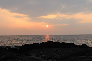

We headed to the beach by the Place of Refuge to watch the sunset.  The food was good, the company excellent (obviously) but the clouds out to sea on the horizon meant there was no ‘green flash’ that night.  Green flashes are nothing more than an optical effect that occur very, very shortly after sunset, when a green ‘spot’ or ‘flash’ is visible, usually for no more than a second or two, above where the sun disappears on the horizon, or, more rarely, it may resemble a green ray shooting up from the sunset point.  A green flash is more likely to be seen in stable, clear air, when more of the light from the setting sun reaches the observer without being scattered - normally these are only seen in the tropics.  On one memorable occasion Mara and I watched a sunset which had a very rare blue/purple flash.

Keolonahihi Park

This has only recently been opened and is a walk among lava, to old ruins and the shore.  A very quiet area.  As we approached the shore it was clear that there were 4 or 5 green turtles (honu) in the shallows.  Our friend Mary was surprised and said she had lived on Oahu for a year and not seen turtles….  This was a hot day on the lava, so we headed into town to find a Japanese restaurant owned by an aunt of one of Mary’s friends.  A note here: everybody in Hawaii has an Auntie somewhere– it’s just the law.  The food was good and we were presented with a (large) tempura ice cream.  Yes - deep (ish) fried ice cream…..
So we then headed to the snorkel beach.  The place for those not so much water babies as water phonics’.  This suits us fine.  We ended up on the beach and Mara offered to sit out the first round, so Mary and I headed into the water in masks and flippers.  There were some rocks to get thru’ before hitting the water.  At this point it’s the sudden change from beach noise to heart beat that you hear; along with some laboured breathing.  After a couple of seconds my eyes adjusted and I floated over the coral and the multi-coloured fish feeding there.  There were yellow fish, zebra fish, silvery blue-ish fish, darker brown fish, other fish and more fish.  It is easy to become mesmerised by the colours, the fish movements and your heart beat. 

Captain Cook and Kayaking

In Kealakekua Bay there is a monument to Captain Cook who was killed by Hawaiians.It's complicated but he basically died as he couldn’t swim. One of the nation’s greatest seafarers, he was attacked on shore after the native Hawaiians decided he wasn’t a god.  His small boat was off shore and he was unable to swim to it, so he stayed on land and was killed.  A couple of days later a few, small, parts of him were returned to his crew). 
We hired a kayak and started across the bay.  When we arrived we saw that there were dolphins in the bay.  here seemed to be two pods (groups) of about 15 each.  Travelling together the dolphins moved across the bay with individual humps coming to the surface, much like a merry-go-round.  As we sat amazed the spinner dolphins would jump (well swim fast) and leave the water head first literally spinning in the air as they did so.  We stopped moving and let the kayak drift, watching as this went on around us.  We then realised that the deep snorting sound wasn’t me knackered from rowing, but the dolphin’s; this was the sound of them blowing air and breathing in as they moved thru’ to the water surface.  We sat enchanted watching and listening.  The sound of dolphins splashing back into the water mixed with the breathing was incredible, as they passed around the kayak.  After a few minutes the dolphins moved away and a little later we started after them.  However they almost seemed to be playing a game, as we arrived at where we had last seen them, they were gone.  Great fun, but tiring. 

 ‘Place of Refuge’ National Park (or Pu'uhonua o Hōnaunau in Hawaiian)

The park is home to some of the most significant traditional Hawaiian sites in the Hawaii.  The place of refuge which is enclosed by the Great Wall, a massive 965 foot long lava rock wall the enclosed area that served as a sanctuary, in ancient times, it served defeated warriors, non-combatants, and those who violated the kapu (taboo or sacred laws); basically get here and your sins are washed away.  Today the area is still one of the most sacred places to the Hawaiians.  The protected waters of the bay combined with the availability of water from fresh (ish) springs provided the ideal location for the Ali'i (Hawaiian royalty) to establish an important residential and ceremonial site nearby, in an area known (today) as the Royal Grounds.  For several centuries, these Royal Grounds and adjacent areas formed one of the primary religious and political centres in Hawaii.

South Point

The southernmost place in the USA (no it’s not the Florida Keys…).  This is a tongue of lava that extends south by 12 miles – 12 miles that resemble in parts, Scotland & California.  The point itself ends at some cliffs (15m) and was very warm and windy, with a small group of guys & gals jumping into the sea off the cliff, no, no, no…   We walked around the area and picked up grains of the green sand that makes the area so interesting.  The ‘sand’ is Olivine, a mineral in lava that is heavier than lava.  As the lava breaks down and is washed away the green Olivine is left behind.  A little north, but with difficult access, is a whole green beach.
We continued on to where we used to live, the Punalu’u, Black Sand Beach (Well… we didn’t actually live on the beach, more the apartments close to the beach….).  The beach is black sand (ground up lava) and has a couple of fresh (ish) water springs.  It’s also a location of choice for turtles to come ashore.  There were about 4 on the beach and a couple more in the water as we arrived.  After viewing the petroglyphs (rock carvings) we headed on towards the National Park.

Ka'u desert

Within the park, this is an area the gets little rainfall and has sand, thus named the ‘Ka’u desert’.  It’s here that in the 18th century a group of Hawaiians were walking thru’ when their footprints were covered in a fine layer of ash.  These footprints (well some of them) were encased and are still visible to today.  So we started down the trial only to realise that it had recently rained….in the desert!  The desert sand was damp!  Anyway an interesting walk, an interesting place, but we only saw the footprints that have been protected by the park service.

Volcano village and the steam vents

So another short trip brought us into Volcano village, where we had lunch before entering the park itself.  After a brief stop at the visitors centre (where we were disappointed to discover that no lava was entering the ocean at present) we headed for the Steam Vents. 
The Volcano’s National park is the only drive through volcano in the world!  The upper section is around the large crater, while the lower section runs down the cliff to where lava (sometimes) enters the sea.  The upper section has three craters inside of each other.  The larger, older, crater is pretty much worn away and only visible on one side.  The second is the more (blindingly) obvious and is approx. 2km wide and has cliffs of up to 50m.  Steam rises from the base of the crater which is made of lava from many old flows.  Finally there is a third crater approx. 200m wide and 30m deep sitting in this crater floor.  This is the Helemaumau crater.  Up until about 5 years ago this was a just another crater which had steam vents.  Now it’s got a lava pool at the bottom and a column of steam and ‘stuff’ that pours out like steam from a kettle (sulphur dioxide (SO2) and sulphuric acid mainly – not a nice thing to breath and so the crater rim drive encircling the main crater is closed for half its length).  The steam column is approx. 200m high before being taken by the wind creating a plume miles long heading out to sea;  approx. 100 tonnes a day of SO2 leaves the vent, nothing compared to the 2000 tonnes a day from the main eruption further away.
The Big Island is made up of 5 volcanos; Hulailai and Kohala are extinct and will never erupt again; Mauna Loa and Mauna Kea are both dormant i.e. may erupt again and Kilauea which is still erupting (in two places) and is currently the longest know eruption to man.

The steam vents we headed to sit on the top edge of the second crater and the steam that comes from them is hot!  While it sounds silly, it’s true; the steam from the vents was unexpected hot (one night when we lived there we visited and were met by a couple of guys using the steam vents to broil the fish caught earlier in the day).  Basically rainwater that trickles down thru’ the rock to hot lava which then boils it like a kettle.  We followed these by walking across to the sulphur banks.  Basically steam vents with sulphur (with nasty rotten egg smell – more SO2) that is in the rocks and is leeched out by the steam.  At the vents the sulphur then crystallises on the rocks or twigs, giving everything a yellow crust. 
  
The Jagger observatory is the closest and best viewing area for the lava pool – and as far along the crater rim drive that’s possible (and safe).  There is no direct view of the lava pool, only the steam column.  During the day the view of the column of steam rising up into the air, it’s very impressive and gives a feeling of smallness when we are compared to the earth……

So we then went over to the Thurston lava tube, set in the dense Ohi’a rain forest – full of birds and rather wet.  As molten lava flows down the side of the mountain, the surface cools.  The lava then flows underground, through these self-made tubes.  The distances that the lava travels are extended since the tube's roof effectively insulates the molten lava, keeping it fluid for a longer time.  When the eruption stops, lava drains from the tube, leaving it an open chamber.  The often thin roof may collapse in time.  The tube is very smooth and has lava ‘tide’ marks where the lava flowed thru’ at different heights and is approx. 10 feet high (about 100m walkable).

There are 20 miles to the end of the Chain of Craters Road, 20 miles of lava and craters.  This road used to lead to a second park entrance.  However lava flows have covered the road, making it impassable.  The sight of the road disappearing under lava with the occasional road sign sticking out is awe inspiring.  Indeed the location of the end of the road has changed over time, since we were there 10 years ago another 2 miles of road has been taken by lava…..

If you head back to the visitor observatory you may see a scene from Dante’s  inferno….The column of steam was now orange, lit from below by the lava pool the steam churned, soundlessly, in dim orange light from the lava.

Lava Tree State Park

This is where in the past lava has flowed passed and around trees.  The trees have slowly burnt away, while the lava has solidified – leaving hollow, upright, lava tubes.  The park contained nearly 100 of these standing ‘lava trees’ in a beautiful tropical setting.  With the sun shining the whole walk through the park is magical. Not far away is another of Hawaii’s famous sites...

Akaka falls

These are the highest waterfall on the island at 422 feet (129 m) – apparently number 612 tallest in the world…  The short trail gives amazing views of the drop of the entire falls. 

Dark in the Park Talk

This talk, which we heard on our last visit, was by three authors, introducing their new book, which highlights the increasing die off of the Ohi’a forests in Hawaii.  This was first thought to be man-made, but has now been identified as a natural process, as the trees deplete the nutrients in the soil and natural cyclical process; however the introduced species don’t help the recovery and could pose a problem for the Ohi’a forests in the future.

At the end of the talk we headed once more to the observatory to look at the glow.  As we pulled up and switched off the car engine, we got out of the car.  As our eyes adjusted we looked up at the heavens.  The Milky Way covered the sky.  A carpet of stars, that as we looked became clearer.  We could see the interstellar dust weaving thru’ the stars, almost like ivy tendrils.  The looming Mauna Loa was lit from behind; not by a town but we suspect the Zodiacal light (light reflected from the interstellar dust).  As we turned around the column of steam from the lava pool was deeply orange with the steam being swept across the sky.  We looked at these natural wonders before looking at each other. We both felt you only get one chance to see such majesty and beauty together. 

For us it will remain the one item of this trip that we will never forget.

Laupahoehoe

This town was build down at the sea edge on a peninsula; but on April 1st, 1946 three tsunamis washed in over town at 7:00am killing many residents including 23 children and four teachers. The children had been gathering fish deposited from the large, but not deadly, second wave on the school grounds while the teachers were in their cabin changing back into dry clothes when the final huge (some say 30 +feet high) wave hit.  No one had noticed the water being sucked out of the bay until it was too late.  Only two children and one teacher survived.  They remained in the water for 10 hours before people on the cliff could get a boat to rescue them since all the local boats had been destroyed by the tsunami.  Hilo suffered also - when you drive into Hilo it has a huge green space along the ocean front.  Actually these are areas destroyed by the tsunami in 1946 and never rebuilt.  Some 120 people died in Hilo that day. 

Along the way to Honokaa you can divert to the Kalopa State Recreation Area.  This is a botanical garden of Hawaiian plants, with many of the native plants maintained in over 650 acres.  A beautiful location that bring to life the native wildlife. 


Waipiʻo Valley

This is beautiful lush valley that was once the playground of the Hawaiian royals.  The Waipiʻo Valley is a mile wide at the coastline and almost six miles long.  Along the coast is a beautiful black sand beach.  Much of the valley was damaged by the tsunamis of the 1800’s and 1940’s (If you have seen the Kevin Costner flop Waterworld, Waipiʻo Valley was ‘dry land’).  We walked a little way down the road, (it’s a paved public road but it is open only to 4 wheel drive vehicles.  If it were classified as a road, it would be the steepest road of its length in the United States and possibly the world.

First published in VISA 113 (February 2014)

Friday, 13 November 2015

A Week in Malta

by David Whiting

[Note: This article is one of the older ones in the Travel SIG archive - 18 years now, but we haven't had many contributions on Malta].

Tuesday - after departing from warm and sunny London, we arrived at dusk - cold, wet, windy! Our self-catering apartment in St Julians, about 20 minutes drive from the airport, was well furnished, but there was no food or drink; fortunately, we had brought some with us - the shops were already shut.

Wednesday - weather was still cold, wet and windy. Still, we were determined to make the most of it. We caught a bus into Valletta, the capital of the island. Many of the local buses are really ancient, up to 60 years old, and we saw several broken-down buses during our stay - although all the buses we took arrived safely! Fares are cheap, but there are no doors, just gaps. Our buses took us along the coast road and waves were crashing over the rocks and beaches. So, occasionally, those sitting opposite the doorways received a soaking!

Valletta is the most heavily fortified town in Europe, with many forts and walls along its coast - it is the largest natural harbour in the Mediterranean. It was made the capital of Malta in 1565 and most of its streets are built on a grid system, although several are very steep. We visited St John's Co-Cathedral (which shares cathedral status with the main church in Mdina, former capital of Malta). It was built in 1577. Its plain exterior hides a richly decorated interior - every square centimetre of the walls, floor and ceiling is decorated with high reliefs, carvings etc. and tombstones on the floor bear knights' coats of arms and trophies. The cathedral museum contains magnificent 17th century tapestries, vestments and hymnbooks. Then we visited the 18-19th century baroque St Paul's Shipwrecked Church, dedicated to the saint who was shipwrecked off the island in AD60. Its decorations are almost as fine as those of St John's Church.

In the early afternoon, it stopped raining and the sun was visible for a while. We went into the former Knights' Hospital, dating from 1575, when it was especially well equipped and could accommodate up to 2,000 patients; it now contains the Malta Experience, a film theatre which shows the history of the island since its first settlement in Neolithic times. Each person uses headphones and uses a dial to select the required language. After the film, it was cold, wet and windy again, so we took the next bus back to our apartment.
Thursday - warm and sunny - as we had expected in the first place! We caught a bus to Valletta, where we were fortunate to see Malta's mounted police - all seven of them -awaiting the arrival of the Canadian ambassador for an official visit. Then we took another bus to Mdina - which had been the capital due to its central location. It is also the highest point of the island, 700 metres above sea level. The name Mdina means "the city" and it was named by the Saracens in the 9th century. The Mdina Experience is a museum with numerous rooms through which you walk to observe life and customs in the island's and city's history.

We also went for a ride in a Karozzin, a horse-drawn carriage. We were taken first to the neighbouring town of Rabat to see St Paul's 16th century church, St Paul's Grotto, where the saint sheltered for three months after his shipwreck, and the town's catacombs. We visited a museum on the site of a Roman villa, containing fine mosaics and other Roman antiquities. Then we were taken back to Mdina to visit the Co-Cathedral, built between 1697-1702. Together with its Cathedral Museum, it was very similar to the Co-Cathedral in Valletta. From its ancient city walls, there are magnificent panoramic views over most of the island. Before we left the city, we stopped at the Mdina Dungeons, a museum of torture and imprisonment from old times - extremely gory in places.

Friday - We took the season's first excursion to Sicily - a long day, beginning at 5.00am and ending at around 1.00am the following morning. We travelled there by catamaran from Valletta to Pozzalo, a journey of a little more than two hours. Local coaches took us into Pozzalo town for breakfast then through the attractive Sicilian countryside, past fruit trees (oranges, lemons, carobs, olives, almonds). The main purpose of the excursion was to visit Mount Etna, Europe's highest active volcano at 3,340 metres - we ascended to 2,000 metres. Snow had fallen earlier that week and was still deep in places yet, in other places, the lava was still warm from the last eruption a few year ago. We could see some houses which had been almost totally buried by lava and others which had survived by a miracle.
Saturday - we hired a car and drove along the coast westwards to travel on the midday ferry to Gozo, the second largest of the five Maltese islands. All roads lead to and from the island's capital, Victoria, and nowhere on the island is more than about ten minutes' drive from it. We first visited the Citadel, the old fortified centre of Victoria, which still contains some ruins abandoned since it was destroyed by the Turks in the 16th century. The cathedral, built between 1697-1711, is less decorated than those on the main island. Victoria has magnificent panoramic views over the island.

Leaving Victoria, we went in search of a sandy beach. First we tried Xlendi, but the beach is only a tiny strip of sand, so we crossed the island and soaked up some sun at Ramla Bay, where there were just a few other people. Three or four were swimming in the sea, but it was almost too cold for us to paddle in! We drove back by way of the Neolithic Ggantija Temples, circular temples with walls made of huge blocks of stone almost intact, dating from around 2,800BC.The people of Malta are quite friendly, but the Gozitans are so hospitable that, if they are expecting guests but have to go out, they leave their keys in the doors! Maltese petrol stations close at 6.OOpm on Saturdays and remain closed all day on Sundays, so we made sure we had enough fuel for Sunday before we left Gozo.

Sunday - we drove east to Marsaxlokk, Malta's largest fishing village. Napoleon's troops landed here in 1798. It has a large colourful market, selling mainly fresh fish and vegetables. The market is only really for Maltese people, but it's very picturesque. Leaving Marsaxlokk, we followed the coast south and west to Wied Iz-Zurrieq to visit the famous Blue Grotto by boat. There are short trips along the coast, in and out of several caves, giving wonderful views of the cliffs. The main cave is called the Blue Grotto because of the way underwater rocks catch the sunlight. Visit the caves in the morning when the sunlight enters them directly.

Near the Blue Grotto is the Hagar Qim Neolithic site, larger than that on Gozo. The temples are much more extensive and it is possible to imagine life in pagan times 4,000 to 5,000 years ago. We returned via Mosta, famous for its huge unsupported dome of St Mary's church, built 1833-1860. It is not as highly decorated as the other large churches we visited, but the size of its dome and proportions were most impressive. A German bomb dropped through the roof in 1942, but it failed to explode; some people call it typically German (or, strictly speaking, Italian, as that was where it was manufactured); others call it a miracle.
Monday - we returned our hire car and went on an excursion called Above and Below. In the morning we boarded a boat at Sliema and cruised around the various harbours and creeks of Valletta. We could see many of the capital's forts and docks during this 90 minute cruise, with a commentary on the places of special interest. After lunch (a big dinner in a smart hotel, although we weren't very hungry!), we boarded a second boat. This one had glass sides below sea level to view the underwater sights off the coast. There is little to see - just a few plants, some rather small fish and some sand.


Tuesday - we caught a local bus to Golden Bay on the west bay of Malta, where we had booked a short horse-riding session along the coast, away from the roads (and potholes!), among the farms and tracks. There were some lovely views along the cliffs and over the sandy bays we passed. The one thing we did not enjoy seeing was the large number of tiny cages used by local people to trap little birds - we felt they were cruel and unnecessary. On reflection, our week in Malta was very enjoyable - not too hectic. You can do things at your own pace - relax and do nothing, or see the sights during the day and go to clubs or casinos at night.

First published in VISA issue 26 (autumn 1997).

Saturday, 7 November 2015

Meet Me in....

by James Allen

The Arch rises above us in an arc, cutting the light blue sky in two. With aching necks we have followed the ever-diminishing trace as it reaches over 630 feet above us. The silver coating reflects the bright early morning light, and behind us the mighty Mississippi river is rushing passed in a 30ft high flood.

It’s Easter 2010, and we’re standing under the Arch of Westward Expansion at St Louis, Missouri, almost at the point that Captains Lewis and Clarke cast off for their three year expedition of the newly purchased lands of the west (the Louisiana Purchase). It was also here, for a few years at least, that the wagon trains departed out across the plains to all points west.

Mara flew out to see her father in South Dakota. I was left at home and work for a week, before I flew out to meet her in Chicago, just before Easter, as I was unable to take more than a few days off. Our initial thoughts were to stay in Chicago – but looking further a field we decided to travel down to Springfield, Illinois - home of Abraham Lincoln - and then St Louis, Missouri, home of the Archway. Our decision was based on not wanting to spend the time just in a city.

We spent the night before Mara left at our friends close to Heathrow, and arrived at Heathrow just after 6am for her (9am) flight. She went into security for departures and I went to work. She arrived in the late evening at Sioux Falls and was meet by her cousin, and driven home, and spent the next week looking after her father and working with her cousin. There was a family get together and a trip to the casino.

I flew from the UK and landed in Chicago and Mara flew in from Sioux Falls within an hour of me. We met at the Hertz car rental - a strange place for a reunion; we then headed down to Springfield, Illinois. The freeway follows or parallels the original route of the famous Route 66, the road that thousands followed in the 1930s depression to escape the dust bowl in the mid-west (it actually runs from Chicago to Los Angeles).

We arrived in Springfield after coming to grips with the local tollways. (I wonder how much money Chicago makes from fleecing foreign tourists. Add that to a new $10 ‘fee’/tax for all US visitors plus all the local and state taxes placed on hotels and cars and you begin to wonder why any tourist would willingly go to the US.)

First thing Thursday morning, we headed downtown to the Lincoln sites. We first entered the Lincoln Presidential Museum and Library. We both felt this was awful. They seem to have out-Disneyed Disney for effects and then deified Lincoln. There was little of substance or history, lots of ‘things’ and sound bites aimed at the 21st century child with a YouTube attention span.

Deciding that we needed history, we walked downtown, past the old courthouse where Lincoln practised and his old law offices, before going into the National Park that his house stands in. This was far more interesting. We had a 30 minute tour of the house followed by a stroll around the restored area. Lincoln was not poor and had a like of ‘modern’ inventions, like wood burning stoves etc. This was where he was during the election for president and then we followed in his footsteps to the railroad station where he left from to go to Washington.

From here we went over to the Frank Lloyd Wright designed house. This was a style of his called Prairie House. Bearing in mind the house is over 100 years old, it still looks fresh today. Indeed the house was built 1902-1905 and was barely 35 years on from the Lincoln house, yet seems 135 years apart. The house is over 19,000 sq ft and includes a bowling alley, organ and furniture designed for the house. We had a tour which took us around the house and showed us the beauty of the design. The history of the house and its owner is varied. Susan Dana Thomas came into her money when her wealthy father and husband died within six months of each other. She spent, in 1902, $60,000 for the house and sold it for $12,000 to a publishing company for offices in 1940, before it passed to the state that now runs it. She had no children; lost her second husband and divorced her third husband and in the 1920s became interested in spiritualism. She moved out from the house in the late 1920s and opened it up for parties, before her death in 1944.

After the FLW house we drove down to St Louis, crossing the Mississippi river and seeing the arch for the first time.

First thing we did on Friday was to leave St Louis and go north across the Missouri river. We headed to the last home of Daniel Boone – frontiersman and all round worthy, or not. First – he did not die at the Alamo (Davy Crockett did); he died in his bed. He was a frontiersman who fought for the British, then supported the revolution and, at the age of 69, accepted an offer to work for the Spanish above St Louis. Granted 850 acres (which he lost when the land grants were annulled after the Louisiana Purchase) he became a Justice and local ‘law’ for the Spanish. The house we visited was actually his son’s, and Daniel with his wife also lived here. The house was built with Indian attacks in mind, having gun ports in the walls and 2 ½ feet thick walls. The very interesting tour goes through out the house and we were the only people on the tour.

We left the house and decided to head for the local wineries. Suffice to say that the California wineries do not need to panic! We visited three and had a small taste in each (coffee and bread at the last one). The local grape seemed to be Norton; which while it smelt nice produced a very dry red without a long lasting flavour. Mara tried a very nice port style wine but not good enough to buy at $29 for a half bottle! Still it was a nice drive along the river.

Leaving here we then headed for the Cahokia mounds. These mounds date from 1000 AD and it is the largest archaeological site in North America. The largest mound has a larger footprint than the great pyramid in Egypt. The site has over 100 identified mounds, contains a woodhenge and a giant sundial and is a UNESCO World Heritage site. Part of the site was contained within a two mile long palisade (containing over 20,000 logs) and was probably the largest city in the US until 1900. All this and I’m guessing most if not all the Americans there (and all the non-Americans) would never have heard of the site before. Some of the mounds were used for burials, some as worship sites and the largest as the home of the chief and/or head priest. The largest mound would have taken over 22 million baskets (at 60lbs or 30kg each) to build (baskets – all the Indians had to carry soil). The mounds are only a state park (not a national park) and contain many (but not all) of the mounds – some have been ploughed over, deliberately removed for soil, washed away or built on.

We went through the very comprehensive museum and watched the video, before taking a walk across the site. We went around the mounds and up to the top of the main mound (named Monks Mounds since some French monks set up here for a few years), which is over 100 feet high. It was very windy but warm, and we could see the skyline of St Louis some 10 miles away. The site is huge and we drove between different parts of the site; it also feels unloved in that the site has been built on, had roads built through it and generally neglected.


On Saturday we headed for the Soulard Market, a farmers’ market. It was interesting (if much like most markets), but we were surprised to see live ducks and rabbits for sale – to raise as livestock!

We then headed over to Forrest Park. This was where in 1904 a World Fair and the Olympics were held. Only a few of the buildings remain, used as galleries or museums, while more modern buildings have been added. We first went to the art museum. This is a well laid out building that contains some great impressionist paintings including Monet’s Water Lilies. We then went on the Missouri History museum. There were two great galleries about Charles Lindbergh (including the Nazi connection) and the World Fair; and two other poorly laid our galleries about the general history, which annoyed us given the other good galleries.

Easter Sunday found as at the bottom of the arch looking into a small capsule approx 5ft by 5 ft by 5ft with five seats. I guess the first astronauts had more room than we did going to the top of the Arch! It was designed in 1948, building started in 1962 and the arch opened in 1967. Access to the top is via the small capsules. The view from the top is breathtaking and gives views for miles around. At the bottom we watched the film about the construction of the arch. The film shot at the time shows that the crew worked without lines and smoked at the full height of the arch!

We then went around the museum, which is laid out in a semi-circle with spokes radiating out. On the ceiling in concentric semi-circles are the decades of the 19th century so, as you follow a spoke out, you go through time. Finally we left the Arch for the old Courthouse. It was here the Joseph Pulitzer (he of the prize for journalism) purchased his first newspaper and it was here that the Scott/Dredd case started. This was where a slave fought for his freedom through the courts with the law and what set off the laws in the southern states that eventually led to the civil war.

Our lasting memory will be standing on top of the large Cahokia mound, warm but windblown
, looking at 1000 years of history around us; wondering, why did they build this? Why?


First published in VISA 91 (Jun 2010)